
 Photo Credit: Jennilee Featherkile / Shutterstock.com
 Photo Credit: Jennilee Featherkile / Shutterstock.com
On the McNeil Point Trail, the rewards for your initial running/hiking climb are numerous, realized in the form of wildflowers (in season) and the looming west face of Mt. Hood.
This run begins at the Top Spur Cutoff Trail #785. Climb about a half mile through old noble fir forest to the junction with the Pacific Crest Trail; turn right and proceed a very short distance to a major intersection of four trails, and take an immediate left on the Timberline Trail #600.
Continue climbing up through switchbacks and along the spine of a ridge with fantastic views of surrounding valleys and, eventually, the mountain itself.
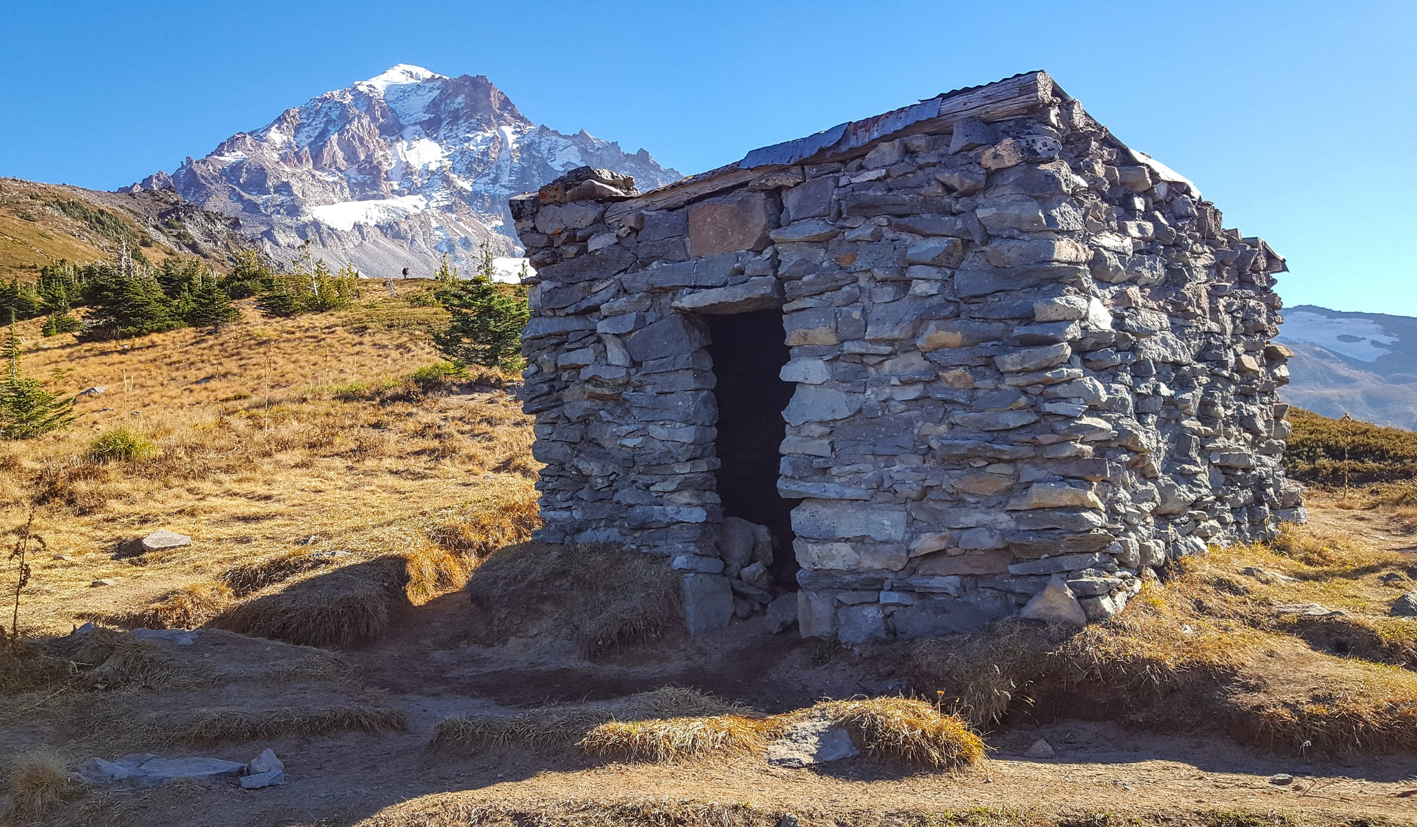
Ascending the ridge you’ll pass a number of seasonal wildflower-filled meadows and interesting tarns. Climb above the tree line and cross more open country until you reach the historic 1930s stone shelter which sits about 800 feet below the actual McNeil Point.
From the trailhead to here and back is about 10 miles round trip; total elevation gain is about 2200 feet (most of this is in the first couple of miles).
Getting There: Take Hwy. 26 east of Portland to Zig Zag, turning left on Lolo Pass Road (Rd. 18). Drive 10.5 miles to the top of the pass and turn right on Rd. 1828. Take 1828 about 3 miles before taking a sharp left on gravel Rd. 118; follow this road several miles to the trailhead.
-Phil Orlowski
