
I ran the Lacamas Heritage Trail alongside Lacamas Lake almost a decade ago and thought that when it comes to running in Camas I had been there and done that.
Turns out I missed the boat, and only just.
A stone’s throw and one intersection southeast of Lacamas Lake is Lacamas Park, 312 acres of forest criss-crossed with miles of runnable trails, from wide gravel roads for floating to sinuous single-track that will have you dodging in and out of the trees.
So runnable. You'll get there soon enough.

Lacamas Park takes in Round Lake and the Mill Pond which used to supply water for Camas’s prominent paper mill. You can run across the dam at Round Lake, out of which flows Lacamas Creek, with its surprising waterfalls and tantalizing swimming holes.
There are lots of different runs you could piece together in this park. What follows is just one basic loop of about five miles that will get you acquainted with Lacamas Park and whet your appetite for exploring the Camas Lily Fields, Woodburn Falls, and any number of other side trips.
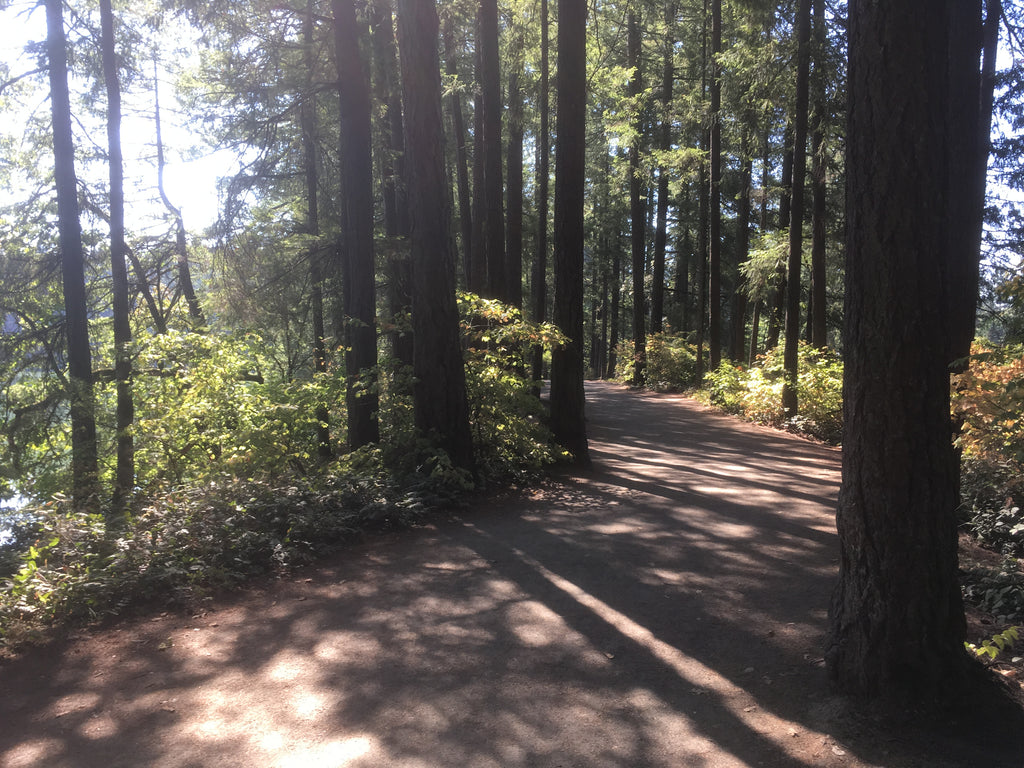
 Just getting started.
 Just getting started.
From the parking area off NW 3rd Avenue, head around the gate into the park. Lacamas Creek flows through the canyon on your right. After .6 mile, you’ll emerge at a picnic grove and the bridge over the lower falls. Drink them in.
 Lower Falls
 Lower Falls
Across the bridge, follow the widest trail heading off to your right. You’ll climb for a bit, and after about a half mile come to a three-way intersection. Heading right will take you to Crown Road and out of the park; instead, head left on the wide, rocky road. Follow this segment down into a gully and over a seasonal stream, then along a sweeping leftward bend that skirts a new subdivision.
Ignore the first sign inviting you to veer right for the Camas Lily Field. Go right at the next major, signed intersection. Round Lake will soon appear through the trees on your left. You’ll descend to its shore, then climb up to a road for a stretch of pavement.
 Turn right here. Round Lake coming up!
 Turn right here. Round Lake coming up!
Go left on the road (35th Ave.) and run on the sidewalk. Just before you hit Everett Street (WA 500), turn sharp to your left and cross the channel between Round Lake and Lacamas Lake. Pass through the developed part of Round Lake Park (bathrooms, play structure, picnic areas) and the paved path will give way to gravel once again, as you traverse a thin strip of land between Round Lake and the Mill Pond.
 A dog retrieves a stick in Round Lake.
 A dog retrieves a stick in Round Lake.
When you get to the Round Lake Dam, with water crashing into the creek below, bear left and cross it. You may need to walk around the assorted levers and cranks atop the dam so you don’t pick up a contusion.
 The top of the dam.
 The top of the dam.
 Looking over the edge of the dam into Lacamas Creek.
 Looking over the edge of the dam into Lacamas Creek.
Once you have crossed the dam, your general inclination should be to bear right. Run alongside the cable fence holding you back from the cliff’s edge. Below you is a popular swimming area and interesting rock formation known as Pothole Falls, where the water has carved deep basins in the rock. You can catch a glimpse through the trees, but don’t be tempted to teeter over the edge for that instagram-worthy shot.
 The rocky outcropping.
 The rocky outcropping.
You’ll presently emerge onto into a somewhat jarring upland scene: a rocky outcropping barren except for dry grass and a few oaks. Look back for a view of the falls, or just look down so you don’t trip. This final half-mile stretch back to the bridge over Lower Falls is the most technical by far. Step nimbly over the many protruding roots and sharp rocks here.

Step carefully. Roots and dappled light can trip you up.

Once back to the bridge over Lower Falls cross it and retrace your steps on the entrance spur to the parking lot.
Here is a decent map of the park. Your navigation is aided by signs throughout with a version of this same map on them.
 Helpful signs like this appear throughout the park.
 Helpful signs like this appear throughout the park.
Amenities: There’s plenty of parking, a porta-potty, and free doggie bags at the start/finish of this run. Real bathrooms and water are to be found at Round Lake Park and Lacamas Lake Park. Brunch after at Natalia’s Cafe at the corner of 4th & Dallas in Camas’s charming downtown.
Directions: Camas is just east of Vancouver, about 20 minutes by car from Jantzen Beach on a good traffic day. Heading east on WA-14 from Portland/Vancouver take Exit 12 for NW 6th Avenue and downtown Camas. Continue on 6th Avenue through the roundabout and turn right about a mile later on NE Adams Street (at the paper mill). Turn left on NW 3rd Avenue. Go straight on NW 3rd for about 3/4 mile. Turn left into the parking area opposite E 1st Avenue. If you reach the intersection with SE Crown Road, you’ve gone just barely too far.
